Seismic Refraction/Reflection/MASW/pVs
Seismic surveys provide information about stratigraphy, hydrogeology, and bedrock topography. Seismic surveys are also a cost-effective way to extend information derived from borehole logs over a much larger area, minimizing the need for costly multiple borings. Crosshole seismic testing, MASW, passive shear wave velocity (pVs, also known as ReMi), and Downhole/Uphole methods are used to determine shear wave velocity as a function of depth to help determine geotechnical properties of soil and rock for Seismic Site Class determination. Crosshole seismic tomography is used to image structures such as tunnels, fault zones, and sinkholes.
Seismic surveys measure the time it takes for reflected/refracted energy waves traveling through the earth to return to geophones at the surface or in a nearby borehole. By analyzing seismic data, it is possible to gain some understanding of characteristics of subsurface layers such as depth, thickness, and attitude.
General Applications
- Municipal and industrial groundwater supply investigations
- Pre-construction surveys
- Environmental audits and site assessments
- Evaluation of active/inactive industrial sites
- Public/private remedial investigations and feasibility studies
- Landfill closures
Specific Applications
- Determine depth of competent bedrock
- Determine depth of water table
- Determine overburden thickness
- Map bedrock topography
- Determine rock and soil properties
- Determine lithology, fractures, and faults
- Determine rock rippability
- Determine Seismic Site Class for IBC requirements
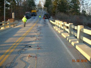
For a surface seismic survey, geophones are set out along a straight line and connected to a seismograph. A seismic source, usually a weight drop or hammer, generates an energy pulse. The time at which reflected or refracted signals are detected at each geophone is recorded on a multi-channel seismograph. The time and distance data are then analyzed and interpreted.
Pavement and noise from traffic, pumps, and pipelines in urban areas present challenges to the collection of seismic data. Topographic changes, e.g., steep embankments, may also increase the difficulty of collecting accurate data. Our extensive experience, state-of-the-art equipment, interpretation methods, and software enable us to overcome the limitations of difficult site conditions and provide our clients with interpretations based on high quality data in places where others can not.
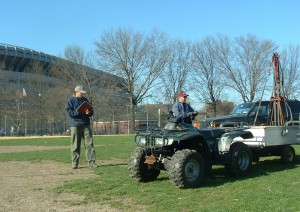
We generally use 48 geophones in a single seismic spread. For a seismic source, we often use an accelerated weight drop system mounted in a small utility trailer that we tow behind a 4WD ATV. This type of source has proven to be a particularly valuable source for seismic signals in urban areas where the use of explosives and firing rods is simply out of the question.
We use the generalized reciprocal method (GRM) and refraction tomography analysis to interpret seismic refraction data. This sophisticated seismic refraction interpretation technique has the following benefits:
- Accurate definition of dipping layers
- Minimal influence from surface topography
- Determination of depth of refracting layers under each geophone
- Overcomes “hidden layer” and “blind layer” problems to determine an accurate depth of competent bedrock
We also perform high resolution shallow seismic reflection surveys using the common depth point method (CDP). Seismic reflection data provide detailed information about subsurface stratigraphy, lateral continuity of layers, and structure.
Surface shear wave velocity testing is an economical method for Seismic Site Class determination at sites subject to the International Building Code (IBC) and similar codes. We perform such testing using low frequency geophones and Multi-channel Analysis of Surface Waves (MASW) and/or Passive Shear Wave Velocity testing (pVs) (also known as the Refraction Microtremor (ReMi) method). The pVs method uses surface vibrations for the source energy, and can be used at sites with vibrations from urban, construction, transportation, and wind noise.


