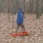
Hager-Richter Searches for Abandoned Military Cemeteries at Civil War Battlefield
Hager-Richter recently conducted surface geophysical surveys at two abandoned military cemeteries within the Wilderness Battlefield Unit of Fredericksburg and Spotsylvania County Battlefields Memorial National Military Park located in Spotsylvania County, Virginia for the National Park Service (NPS).
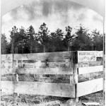
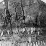
The Battle of the Wilderness of the American Civil War was fought on May 5 – 7, 1864. Two cemeteries, Military Cemetery No. 1 and Military Cemetery No. 2, were established as repositories for the remains of soldiers who fell in the battle. The two cemeteries were surrounded by wooden fencing, and the graves were marked by wooden monuments. The cemeteries existed for only about one year, after which the remains were disinterred and moved to the Fredericksburg National Cemetery. The sites of Military Cemetery No. 1 and Military Cemetery No. 2 were then abandoned.
The approximate locations of Military Cemetery No. 1 and Military Cemetery No. 2 were known, but their exact locations and extents were not known. The purpose of the geophysical surveys was to locate the former cemeteries and to define better their boundaries. The geophysical survey results will be used to aid the NPS in its efforts to develop interpretive opportunities and to make the abandoned military cemeteries accessible to the public.
Military Cemetery No. 1 was located near battle earthworks in the western part of Saunders Field, and Military Cemetery No. 2 was located in a wooded area a few miles to the south. The NPS specified the geophysical search locations based on historic photographs since there was little visible surface evidence of the former cemeteries. After all, almost 150 years have passed since the cemeteries were vacated. The geophysical signatures for the former cemeteries were expected to be quite subtle since hand-dug trenches and perimeter fence post holes likely would not provide strong contrasts with surrounding soils that also had been disturbed by the battle.
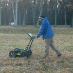
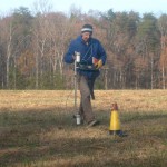
Hager-Richter used complementary geophysical methods specified by NPS — ground penetrating radar (GPR), electromagnetic induction (EM38), and magnetics. High resolution geophysical data were acquired at close intervals along lines spaced 1/2-meter apart.
The results have been reported to the NPS. Geophysical evidence for Military Cemetery No. 1, which was located in an open field, is less clear than the geophysical evidence for Military Cemetery No. 2, which was located in a wooded area. Perhaps the woods protected Military Cemetery No. 2 from later disturbance. NPS staff had previously observed faint surface depressions at Military Cemetery No. 2, although they were not visible under the thick leaf litter at the time of the geophysical field work. The GPR results for Military Cemetery No. 2 were especially useful, and regular rows of possible grave shafts were detected. We hope to work with the NPS in a slightly expanded search area at Cemetery No. 1 to better define its location.
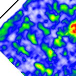
Possible grave shafts indicated by green blebs in a GPR time slice plot for ~1.4 m depth at Military Cemetery No. 2
