Magnetics
Magnetic surveying is ideal for both reconnaissance and focused surveys. It is expedient and cost effective, covers more ground in less time, and requires a minimum of field support. The portability of the instruments makes magnetic surveying well suited to sites with topographic variations.
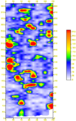
Magnetic surveys measure the earth’s magnetic field very accurately. Buried ferrous materials, and in some cases, changes in bedrock lithology, produce disturbances in the local magnetic field that can be readily detected by magnetic surveys.
Station measurements are made and digitally recorded in the field. While the survey data are collected, a nearby base station automatically records data to track the diurnal variation in the earth’s magnetic field.
As with any survey technique, magnetic surveys have certain limitations. Overhead and underground utilities, fences, and buildings may interfere with the collection of accurate data. Our experience allows us to advise you on the suitability of the magnetic survey technique for specific projects.
The accuracy and thoroughness of our magnetic surveys are enhanced by our state-of-the-art field equipment. We use microprocessor-controlled cesium vapor magnetometers that measure both total magnetic field strength and the vertical magnetic gradient. The gradient data help us discriminate near surface objects from objects that are more deeply buried. We use one magnetometer as a dedicated base station to ensure the accuracy of the field data collected with the survey magnetometer. We use the base station data to correct for diurnal variation of the earth’s magnetic field and to detect magnetic storms.
General Applications
- Environmental audits and site assessments
- Landfill closures
- Construction projects
- Geological mapping
Specific Applications
- Locate buried ferrous metal objects, including drums, underground storage tanks, utilities, and ordnance
- Locate buried mafic dikes